PikasGPS
The system ,,PikasGPS" is designed for public traffic control, management and accounting referring to GPS or GLONASS data.
The system “PikasGPS”
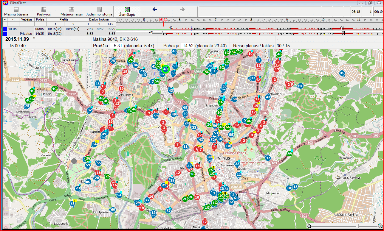
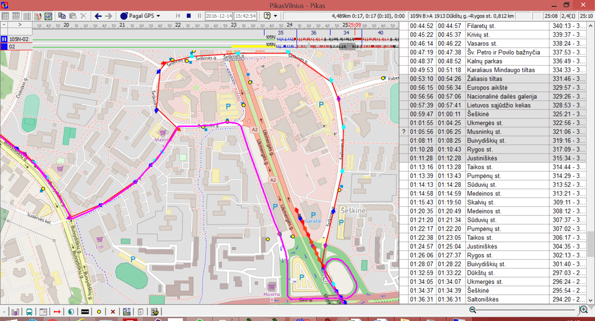
- The map provides real-time public traffic flows. The selected tour or all routes may be monitored.
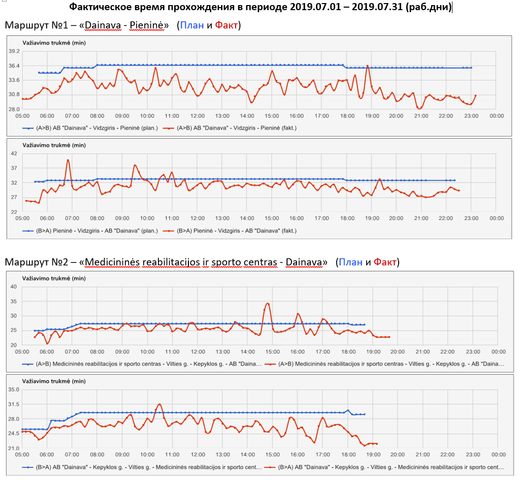
- Presentation of transport delays/early arrivals according to the selected routes
 .
. - On-line real-time service of the information system .
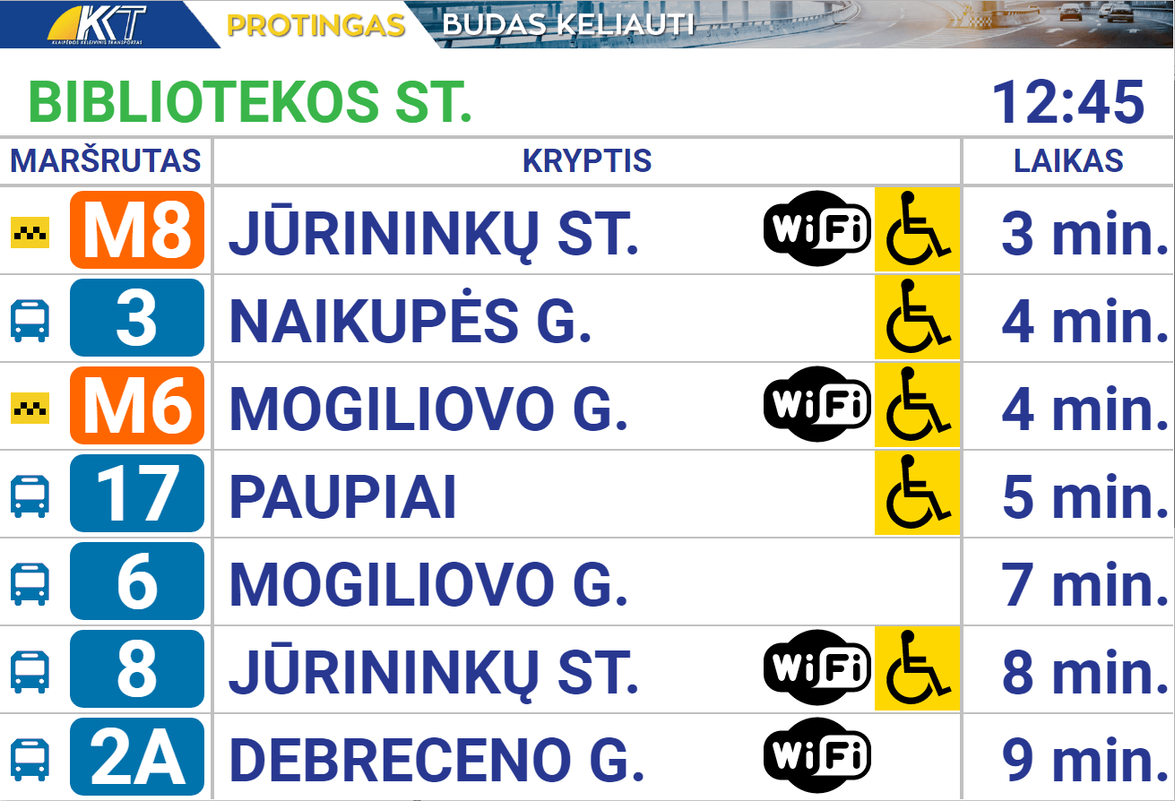
- Presentation of transport arrival times on display panels installed at stops and for smart phones .
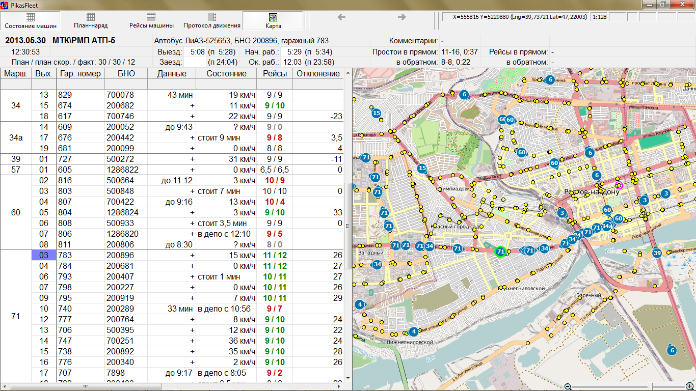
- Accumulation of traffic history and provision of historic data according to the selected date and time .
- Composing of statistical reports according to the actual transport operation (trips, mileages, quality analysis for passengers). Analysis of target and actual traffic timetables .
- The application operates both with data provided by board computers, and with any GPS (GLONASS) devices which send position data to the specified server’s IP address (GPRMC, Glospace). Data exchange formats provided by the user are supported (textual/binary message format).
Gallery