Pikas
The system “Pikas” consists of the following three modules:
1. “Pikas”,
2. “PikasWWW”,
3. “PikasMobile”, designed for public traffic planning, coordinating and publication of the information about public traffic on the Internet and in smartphones.
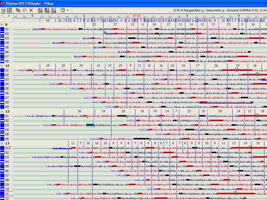
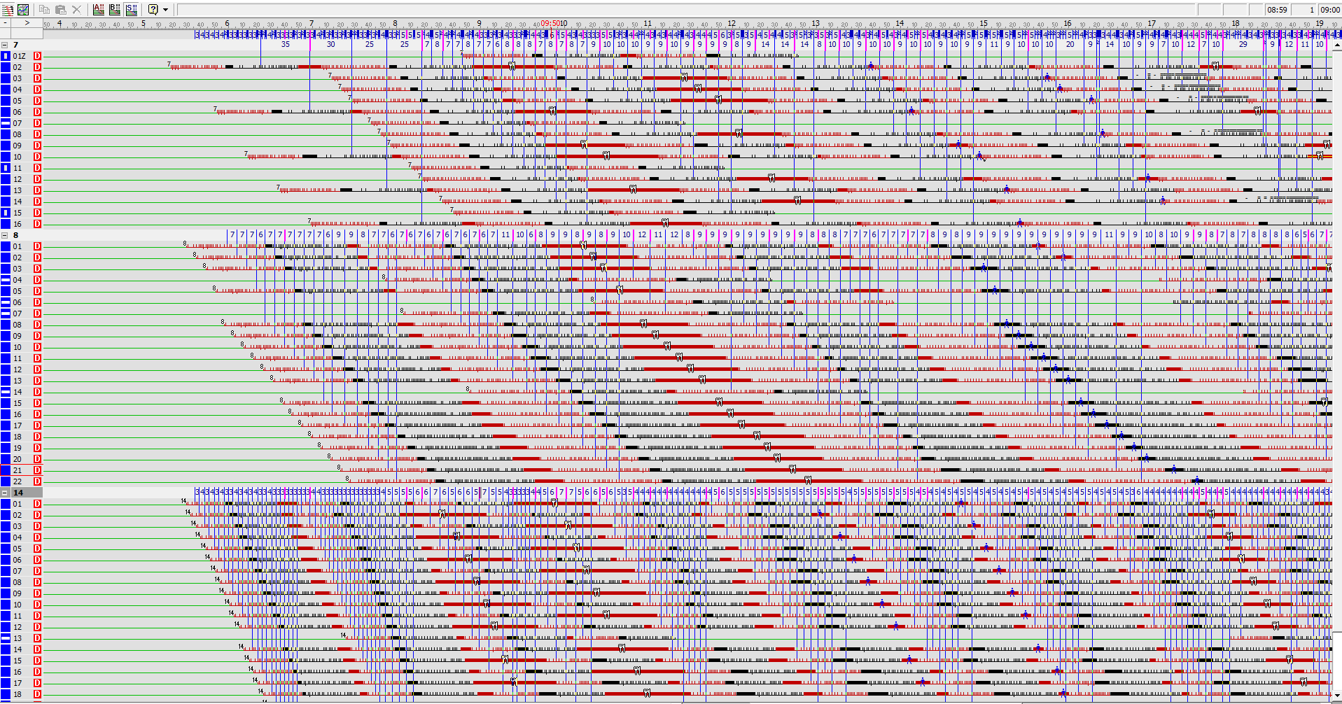
“Pikas” is designed for planning of public traffic of all kinds (making of timetables), as well as modelling and coordination according to the desired interval between vehicles or according to the desired quantity of vehicles per day. The system has a unique graphical editor, designed not only for planning of unlimited quantities of vehicles and routes, but also for coordination of these routes in any point of a city or a country in all directions. An internal map editor is also integrated into the system.
Innovative solutions:
- There was developed an original graphical editor of timetables enabling coordination of not only timetables of public traffic routes of a city, but also timetables of all kinds of traffic of a country (buses, trams, trolleybuses, microbuses, planes and ferries) in all directions and in any point (at stops, crossings, railway and bus stations, airports and harbours). It is possible to simultaneously coordinate over 50 routes in various points of a city (a region, a country) and to rapidly review coordination results in the simulation mode. It allows significant improvement of passenger servicing quality
 .
. - There was developed an original timetable production algorithm enabling optimization of operation of vehicles according to passenger traffic (e.g. according to the desired interval during a day or quantities of vehicles per day), as well as saving of electric power and fuel. In individual cases, for example, when the interval is increased by 1 to 2 minutes, one vehicle per route may be “saved”. In 2000 this algorithm was highly rated in the international Berlin conference „Computer Aided Scheduling in Public Transport“ . The algorithm saved app. 3 million USD in Vilnius (at the time Vilnius had 0.5 million residents). Interesting information from the story – we are the first in Europe to start providing public transport timetables for mobile phones via SMS in 2002. The partners of this service were mobile operators "Omnitel" and "Bite".
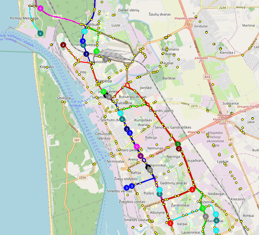
- An internal map (“Open Street Maps”) editor is integrated into the system. It incorporates the following functions:
- to place stops (their codes, names, pictures, to define what is equipped at the stop: a city map, a bench, an awning, who maintains the stop,
- to draw sections between stops or crossings,
- to define the dynamics of speeds or pass-by times between stops or crossings during a day for individual types of transport (+ for individual routes, + periods of year or seasons, + for work and rest days, + for holiday days, + for school holidays, + for the chosen week days).
- Maps submitted by a user may be also used (from a GIS server or as popular graphical files: .emf, .wmf, .png, .gif, .jpg).
It enables production of high quality timetables (i.e., when drivers arrive to the stops due time, following the timetable). The quality of timetables is increased by processing of data received from „PikasGPS“, because statistical data about congestions of traffic during the whole day are used ![]() .
.
Other functions of Pikas:
- The graphical editor incorporates various commands allowing easy establishment of trips, altering of parking times at final points (and at stops), altering of composition of street segments in certain directions, altering of departure and arrival times, altering of speeds in individual street segments or for the selected trips, transferring of vehicles to other routes, etc.
- When traffic for individual (or all) routes is planned, on the map traffic simulation of the selected routes may be launched enabling fast noticing of street segments which require traffic coordination (due to the issue of a congestion or transfer to other routes).
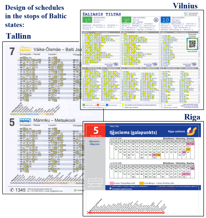
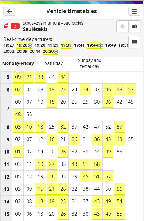
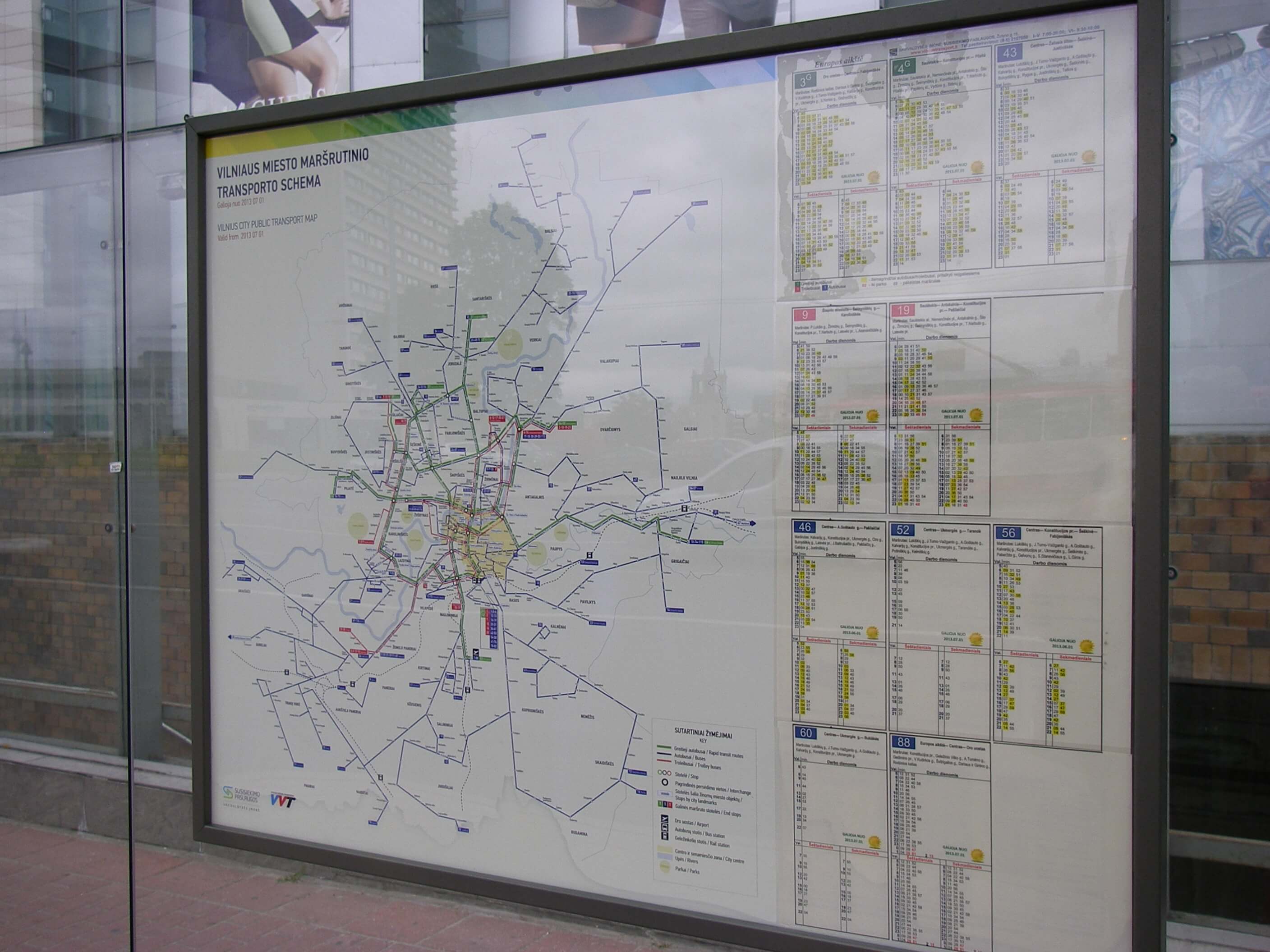
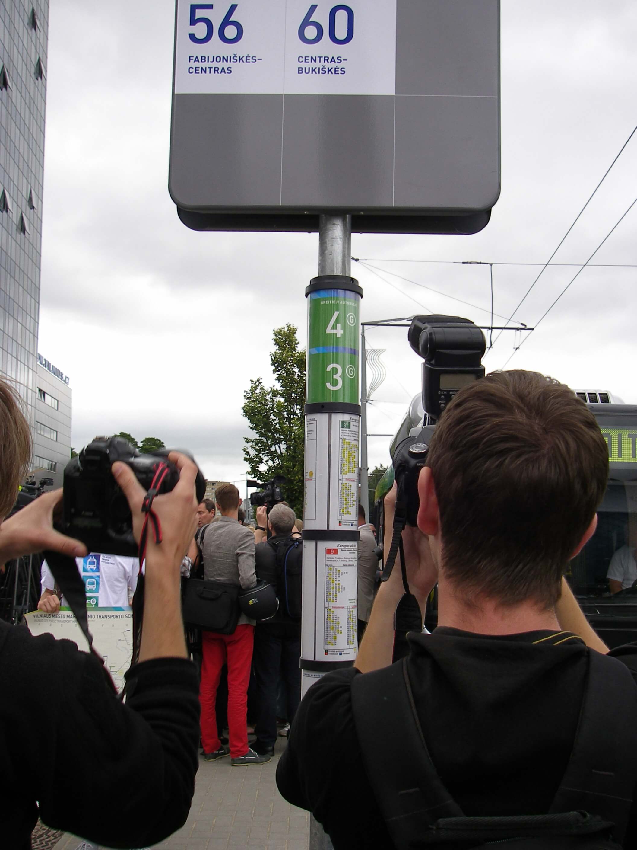
- Composing of schedules for traffic superintendents, drivers, controllers and passengers in EXCEL tables. Composing of timetables for all stops (for the selected group of stops or for the selected route) and production of reports in EXCEL. Traffic schedules generated with the “Pikas” program are provided in the city of Vilnius alongside maps equipped in the stops pavilions (A18-Foto) or in special cylinders near stops .
- Export of timetable data into XML and GTFS formats which are used by other systems: SWARCO, THOREB, EMME-2, ect.
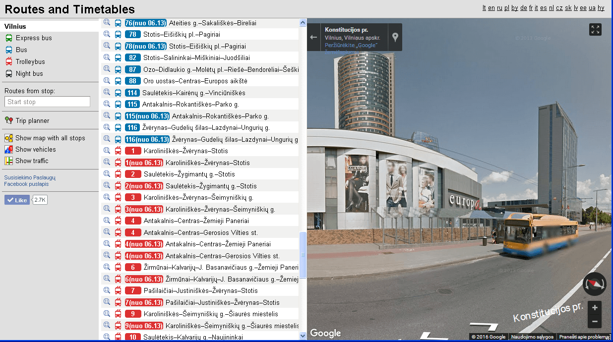
“PikasWWW” is designed for publication of public traffic timetables on the Internet and in mobile telephones (including search for the fastest route /journey planner/):
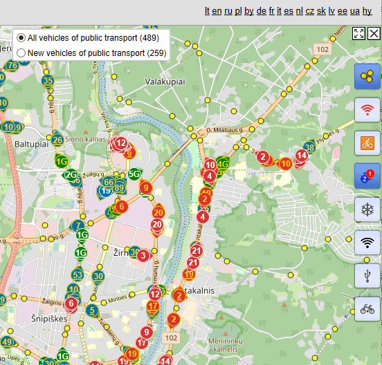
- Module „PikasWWW“ in internet take a list of public transport routes of a city (a region, a country) and all information about operation of the routes. The routes are divided according to the type of transport (buses, trolleybuses, trams, microbuses, night buses, rapid buses, etc). The routes where low-floor vehicles (suited for disabled persons) operate and times of arrival of the vehicles are distinguished. Besides, the routes (and buses) which going to airport or where carriage of bicycles is available are distinguished.
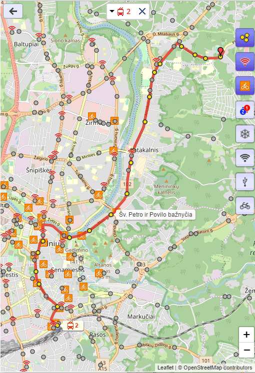
- Selected routes, stops are output on the map (Google Maps, Open Street Maps, the map provided by the customer). The stops with Wi-Fi, bicycle rental are distinguished .
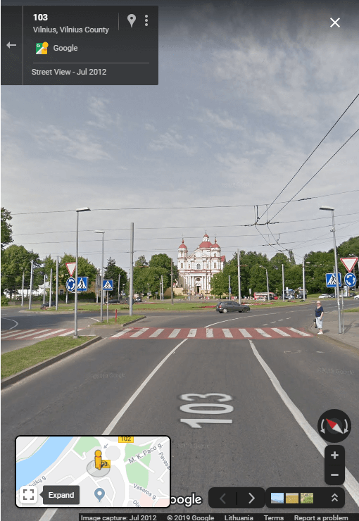
- “Street View” function works on the map, it allows viewing panoramic images of the selected street or stop .
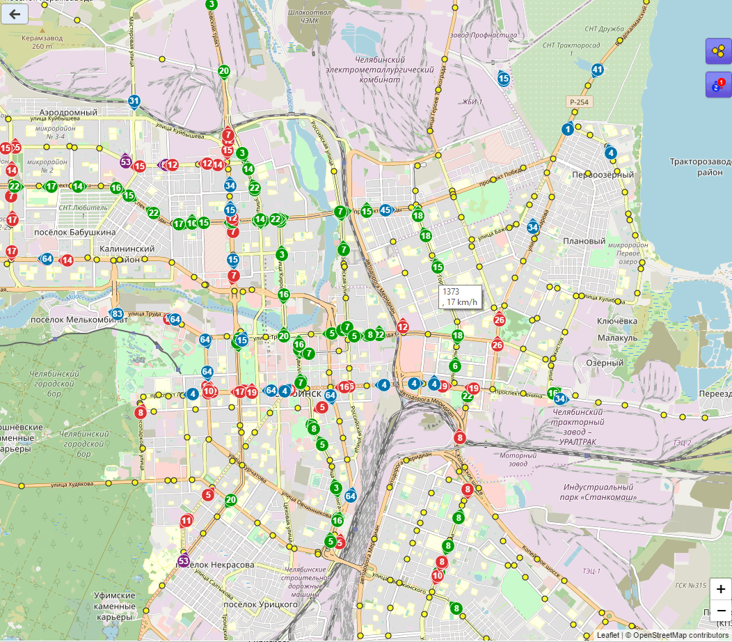
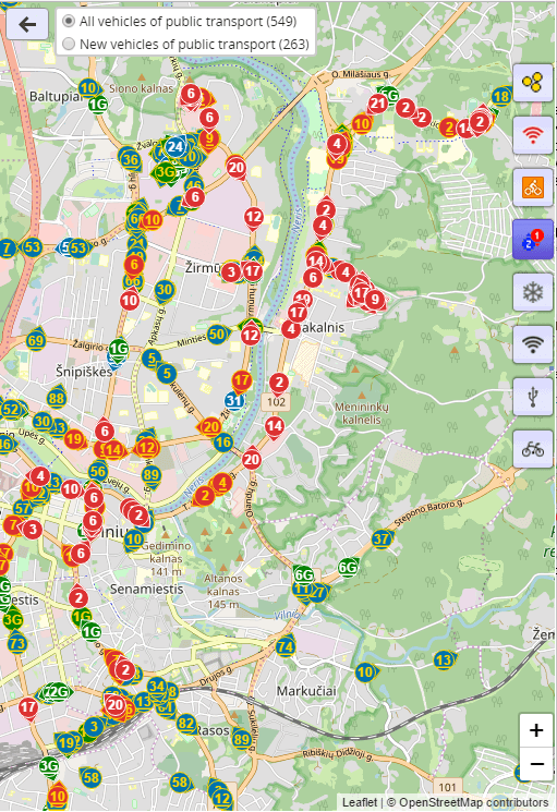
- There is a possibility of real-time monitoring of traffic of the selected (or all) routes. When the mouse is pointed on certain vehicle, its speed is shown . Traffic congestions are also shown.
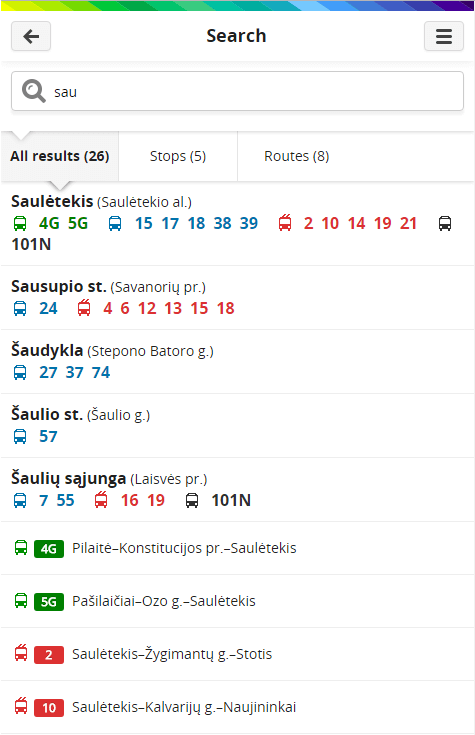
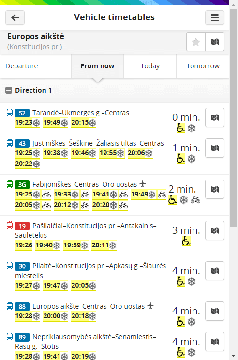
- All routes of transport which stops at the certain stop, departure times (from now, today, tomorrow) are output for the selected stop (according to its name or selection on the map). When selecting a stop, there is a prompting function (when several letters are entered, all stops, names of which contain this sequence of letters, are offered).
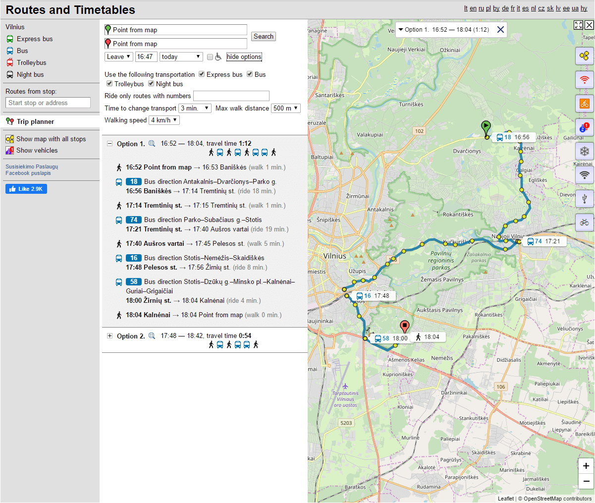
- Search for the fastest route between the selected stops by entering their names or by marking them on the map or between the selected addresses. Several alternative variations and travel durations including all possible transfers, transfer durations, walking distances between stops, etc. are provided .
- The GTFS format is supported.
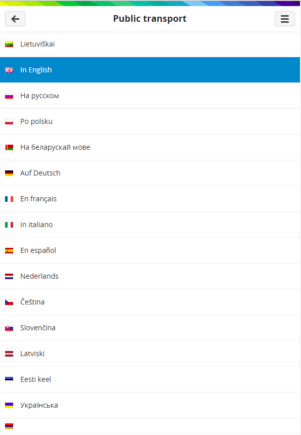
- Vilnius public transport timetables are provided in 16 languages: LT EN RU PL BY DE FR IT ES NL CZ SK LV EE UA HY, e.g. www.stops.lt
“PikasMobile” is an application supported by mobile telephones and tablet PCs, designed for search of an optimum route and provision of public transport timetables and information, related to real-time traffic flows to users. The application is realized following the HTML 5 standard, it may operate on the browser in the same way as an independent mobile OS (Android, iPhone, Windows Phone) application or it may be integrated into other mobile OS applications, e.g. into m.Ticket application.
Functions:
- Convenient (for users of mobile devices) for viewing of timetables for the selected route or at the selected stop ;
- Possible search for a stop or a route according to its name or a share of the name ;
- Panoramic view of the selected stop ;
- Planning tool of the fastest route between the selected stops or locations on the map ;
- Representation of routes and stops on the map ;
- Real-time representation of movement of transport on the map ;
- Representation of traffic congestions on the map;
- Planned (following the timetable) departure times at the selected stop;
- Forecasted (following real circulation of vehicles) departure times at the selected stop ;
- Support of user interface in different languages ;
- Possible marking of desired stops, routes and timetables at a stop for their fast reaching;
- Possible alteration (adaptation) of user’s interface referring to new client’s requirements;
- Possible presentation of “PikasMobile” as an application supported by Android, iPhone and Windows Phone platforms;
- Possible integration of “PikasMobile” as a subapplication into other mobile applications (e.g. “m.Ticket”)
- “PikasMobile” saves route and timetable data on the mobile phone, that’s why it also functions offline. When connected to the Internet, more recent timetable data (if they were altered) are downloaded and memorized on the phone;